|
World Tide 2014 (Available on January 5th)
• Over 3400 Stations World Wide
• Contains 1 year worth of tide predictions
• No Internet connection required
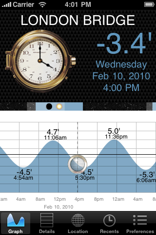
• 7 day tide graph based on the current time
• Built in map for easy port selection
• Detailed high/low tide event list
• Sun / Moon graph with moon phases
• Choose between meters or feet
• Uses GPS or other location services when available.
• Does not include Canada, France, Hong Kong or other countries which charge licensing fees for basic 7 day predictions. Please petition your local hydrological office and ask them to make this data available for free to developers like us. Otherwise, we will never include them in our app because we would go broke or have to charge you an arm and a leg :-(
LIST OF LOCATIONS
World Tides was written from scratch especially for the iPhone and iPod Touch. It is an entirely self contained tide prediction application that you can use anywhere.
Warning: Tide Prediction software is not perfect. It does not account for storms, shoals, wind, geographical changes, or other common events. Therefore, you should not rely on this software or any other tide prediction software for navigational purposes.
New Features
If you see a feature that we are missing and would like us to try and add it to the application, please drop us an email and we'll do our best to accommodate your wish.
|
Frequently Asked Questions
Q: Do I need an internet connection?
A: No. But, if you have location services enabled, you can use it to locate your position on the map.
Q: Is there a tide station in my area?
A: Most likely, yes. There are multiple stations throughout the world. However, some countries refuse to give us their data without charging us what they would charge professional navigation software companies. But, if you need professional software, then you need to pay a lot more for it. This app is for non-professional use and it is priced accordingly.
Q: Are the tide predictions accurate?
A: Most of the time they are within a few percent. The tide predictions are based on dates and station harmonic constituents. It is based on real-world measurements and it can be very accurate at times. However, there is no tide prediction software that can account for things like storms or natural disasters. Also note that the high and low tide levels are rounded to the nearest 1/10th of an hour.
Q: Can I get more than 7 days of predictions?
A: No. Our free license agreement prohibits predictions of more than 6 days plus the current day.
Q: How do I reset the time?
A: Tap on the clock and the time will snap back to within 6 minutes of the current time.
Q: Does this account for daylight savings time.
A: Yes. The closest city for each tide location is used as a reference to determine if daylight savings time is observed. Adjustments are made accordingly to the graph.
Q: How do I select a station?
A: Dragging the map with your finger will change the selected port (in red) closest to the center of the screen. Zoom in by double tapping or pressing the zoom-in button if desired.
Q: What happens in 2011?
A: World Tides 2010 only has tide predictions for the year 2010. At the end of the year, the program will run out of data and you will see an expired message. World Tide 2011 will be released as a separate product. We have no choice but to do this because our license for the data expires at the end of the year as well.
Q: How does it predict the moon and sun events?
A: This is done based on the lat/lon of the tide station. It uses some very complicated formulas that we can't begin to explain because we barely understand them ourselves. But, thanks to some very smart scientists, this software attempts to accurately predict rise and set times down to the minute.
Q: Is it possible to have two sun rise or sun sets in one day?
A: Believe it or not, YES! And you don't even need a daylight savings time event to happen. You'll have to Google it for more details, but the software was written to handle this occurrence. We are fairly certain we got it right.
Q: What are the shaded areas for in the Moon/Sun bar?
A: Black = Night with no moon, Gray = Night with a moon, Blue = Day with no moon, Light Blue = Day with a moon. This bar is intended for a quick glance at the day. For details, just hit the Details tab at the bottom.
Q: Why does Tide Graph have more US stations?
A: Because Tide Graph uses an entirely different set of data. World Tide licenses its data from a different source.
Q: Can you add more tides to the software?
A: No, we have no control over the list of tide stations. You can try writing your local hydrological office and ask them to set up measurement stations for more tide locations.
Known Issues
The exact time of the high and low tide is calculated based on the peak and valley of the curve. When the curve is pretty flat, then the high and low tide times span over longer periods of time. In some cases, these times could be up to an hour or two long. So, the exact time of the high and low times may not match other predictions. This is why we show you the curve. Just knowing the high/low tide times does not tell you very much.